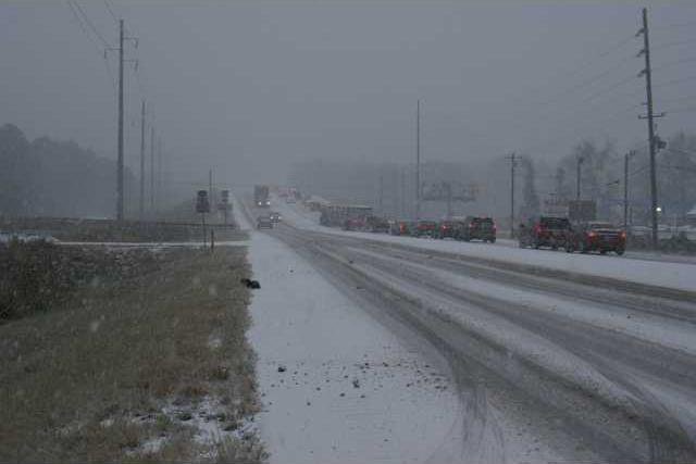
The sleet and snow that fell across Liberty County Wednesday was responsible for roughly 81 weather-related accidents, according to Liberty County Emergency Management Agency Deputy Director Larry Logan.
Of those, Georgia State Patrol Post 11 said they responded to 19 accidents. Hinesville Police investigated eight minor incidents, according to Officer Scott Hensler.
The Liberty County Sheriff’s Office responded to 68 motor vehicle calls, according Maj. Jeff Hein.
Hein said those calls included accidents with minor injuries and stranded motorists, He said two LCSO patrol cars were also involved in weather related incidents, one included an accident where a LCSO patrol and a GSP vehicle hit each other.
Fort Stewart Public Affairs Officer Kevin Larson said they had about one dozen vehicle incidents on Highway 144 through post. He said the road was closed briefly Friday, but soon reopened, though the road motorist were being advised to seek an alternate route. He said icy conditions remained Friday and drivers are still advised to stay off 144 until the weather completely clears.
Wednesday’s storm was called a bomb cyclone. According to AccuWeather the scientific name for the storm is bombogenesis, which is a storm that undergoes rapid strengthening. All storms are cyclones, and genesis means the creation or beginning. In this case, bomb refers to explosive development. Altogether the term means explosive storm strengthening.
Wednesday’s bomb cyclone, Winter Storm Grayson, also left 5,000 customers temporarily without power, Logan reported. As of Friday morning all power outages have been restored.
Liberty and Long County reportedly received 2 inches of snow, based on a report issued by the National Weather Service, Charleston. The report, however, does say the figures posted on their initial release were submitted by their storm spotters and are listed as unofficial observations.
Grayson marked the first accumulation of snow in the area since 1989. There was a brief snow flurry in 2010.
Storm leads to slippery roads, worse