Hurricane-preparedness experts successfully have reduced a 500-plus-page binder filled with storm-surge maps and other valuable data to a single interactive CD.
Digitizing the 2013 Georgia Hurricane Evacuation Study should make this information more accessible to coastal-community leaders and help local governments better plan for storms, they said.
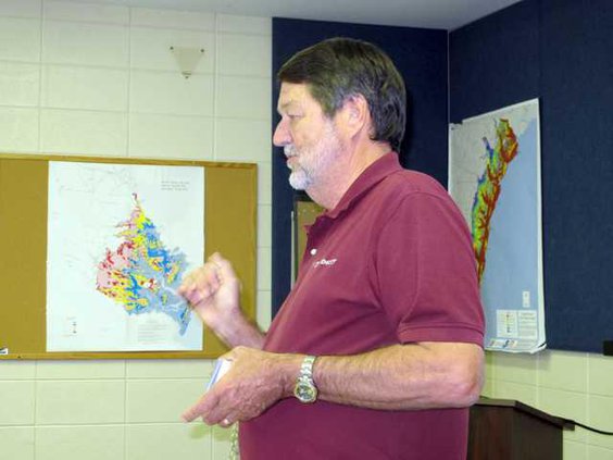
Jeff Morris, a project manager with the U.S. Corps of Engineers, and Bill Massey and Lauren Hand with Dewberry Consultants LLC offered city, county and industry officials an overview of the evacuation study and a brief training in how to use the CD.
“We’ve come up with a way to put this information at your fingertips,” Massey said.
The hurricane-preparedness experts presented the computerized study in Liberty County on Wednesday and in Bryan County on Thursday. They plan to meet with community leaders in each of Georgia’s six coastal counties.
Massey and Morris explained that the data in the study was compiled from a myriad of sources, including 2010 Census figures, traffic patterns, behavioral surveys, LIDAR (Light Detection And Ranging) — which is precise topographical information collected by aircraft — and storm-surge maps developed from historical and scientific analyses.
Among those who attended Wednesday’s presentation in the county EOC were Hinesville Mayor James Thomas, Assistant Liberty County Administrator Bob Sprinkel, Walthourville Public Works Director Jimmie Martin, Riceboro City Councilman Tommy Williams, Hinesville Fire Chief Lamar Cook, SNF/Chemtall EHS Manager Wil Porter, Liberty County Public Safety Communications Director Tom Wahl, Judy Patterson with the U.S. Corps of Engineers Savannah District, Liberty County Building and Licensing Director Paul Zechman, Scott Wall with Liberty County Geographic Information Systems, Flemington City Administrator Terri Willett, Midway Mayor Clemontine Washington, along with Glenda Roberts and Georgia Holiday from the Liberty County Tax Assessor’s Office, and Liberty County EMA Director Mike Hodges and Deputy Director Larry Logan.
Hand, a geographer, showed attendees how to navigate the program, view various layers of storm-surge maps, and to see how high flood waters can reach via photographs of local landmarks. Morris emphasized these storm-surge illustrations and maps for hurricane categories 1-5 on the CD show a worst-case scenario.
As one example, Hand showed a photo of Riceboro City Hall. A shaded blue area transposed on the photo illustrated that floodwaters in a category 4 storm could reach 7 feet, and could go as high as 10-11 feet in a category 5 hurricane.
“This doesn’t include waves,” Massey said. “This is static elevation.”
He said a 10-foot storm surge would support a 5 1/2-foot wave over it.
Massey said that flooding from hurricanes and tropical storms is a major cause for concern, even though Liberty County has areas with relatively high elevation compared to other more low-lying coastal counties. He said that Georgia’s barrier islands would not necessarily protect the coast from severe storms.
Massey explained that because Georgia has a shallow continental shelf, a storm’s intense winds easily could push water onto land. He said witness accounts recorded after an 1898 storm hit Georgia head-on tell of corpses found in the top-most limbs of trees once floodwaters had receded.
Although it has been more than a century since the state experienced a direct hit, that doesn’t mean it can’t happen today, Massey told local officials. He commented that rain and flooding from a storm markedly could impact an area, even if that area doesn’t receive a direct hit.
Sprinkel agreed with Massey, adding, “When water came in on (Hurricane) Sandy, it blew in and (rose) up — like you would fill up a bathtub.”
“The solution is, get the heck out of Dodge when the county tells you to leave,” Massey said.
Hand went on to demonstrate how users can read the study’s text and then use hyperlinks to pull up corresponding storm-surge maps. She showed how users could access other types of information connected to each map, such as where low-income, elderly or disabled populations might be located. These at-risk populations likely would most be in need of transportation assistance during an evacuation, Hand said.
Thomas said another part of planning for hurricanes is taking care of residents after a storm. Most people want to know how soon they can return to their homes after an evacuation, he said.
“There’s no pat answer,” Massey responded.
The former FEMA official said there are many factors involved in the decision to allow residents to return to a storm-ravaged area. Residents’ safety is key in determining this, he said.
“You don’t want people back if power lines are on the ground, if there are gas leaks or roads are undermined,” Massey said.
“It could take eight to 10 to 12 hours to evacuate,” he said.
But a community’s full recovery from a major storm could take up to 12 years, Massey said. He cited New Orleans’ continuing efforts to recover after Hurricane Katrina hit the Gulf Coast in 2005.
Logan said Liberty County EMA is taking a hard look at re-entry plans, storm debris clean-up and removal, as well as planning for evacuations.
Storm evacuation data digitized, made easily accessible