
The NWS Storm Prediction Center has issued a Tornado Watch for portions of northern Florida, southeastern Georgia, central and southern South Carolina coastal waters.
Primary threats include, possible tornadoes, scattered damaging wind gusts to 70 miles per hour, isolated large hail events to 1.5 inches in diameter possible.
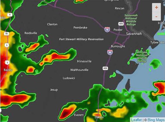
An area of thunderstorms now spreading across parts of central and southern Georgia, and adjacent portions of northern Florida, is expected to continue developing northeastward across parts of the piedmont and coastal plain of South Carolina through this evening. This activity coincides with strengthening wind fields which will support a risk for tornadoes and potential damaging surface gusts.
The tornado watch area is approximately along and 65 statute miles north and south of a line from 15 miles south southwest of Vidalia to 50 miles east northeast of Orangeburg, South Carolina.
A Tornado Watch means conditions are favorable for tornadoes and severe thunderstorms in and close to the watch area. Persons in these areas should be on the lookout for threatening weather conditions and listen for later statements and possible warnings.