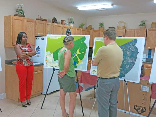
Fleming residents met again with Liberty Consolidated Planning Commission staff Thursday afternoon to approve updates to the future land-use map as part of the Liberty County Comprehensive Plan for 2014-15.
LCPC planners Melissa Jones and Joey Patenaude met with residents at Living Word Church of God on Freedman Grove Road to present an updated map that was revised from information provided by residents May 22. Eight residents attended the follow-up meeting.
“This map is the current land-use map,” Jones said, pointing to the map residents discussed at the last meeting. “This one reflects the changes you told us in May that you wanted to make. What we propose is to change the (Highway) 196 corridor from residential, low-density to a mixed-use rural corridor. We’re not proposing a Walmart or anything like that, but something like a gas station/convenience or bait shop...
“This is a 20-year plan. If any other convenience store is going to be built, it’s most likely going to be on (Highway) 196. I need you to tell me what you want in your community.”
Jones explained the proposed future land-use map was just a small part of the county’s comprehensive plan, which is updated every five years. She said the plan protects Liberty County’s “qualified local government” status, preventing another county from annexing its rural communities.
Patenaude reminded residents of differences with the current plan, including changing two areas listed as industrial to commercial. During May’s meeting, resident Robert Long expressed concern that leaving the sites’ land use as industrial might allow for an undesirable industry to locate there.
Long’s wife, Nancy, who was not present for the May meeting, asked about a large blue area on the current map now designated in yellow on the revised map. Patenaude said that was the Habersham Plantation, which originally was zoned mixed-use, rather than residential. Last month, LCPC Director Jeff Ricketson recommended changing it to residential, low-density, and everyone agreed. Jones explained that LCPC staff put on the revised map what’s actually at a particular site at this time.
“The good thing about this map is that most of the areas designated as residential are already residential,” Patenaude said, explaining that if a developer wanted to request an area be changed to commercial, it would have to go through the Liberty County Board of Commissioners. “That’s a 45-60 day process. If you live within 200 feet of property proposed for re-zoning, you’ll get a letter in the mail about the board meeting.”
He told them about a proposed zoning change in another Liberty County community that residents strongly opposed. He said that so many residents appeared at the board meeting, the decision had to be postponed, pending additional information. The same option would be open for Fleming residents if a developer wanted to build something on the Highway 196 corridor.
“I would hope that wouldn’t allow for something like a Silver Dollar to come in here,” said Josh May, pastor at Living Word. “That would be my biggest concern.”
Jones and Patenaude both told him it would not, and that any new business would have to be approved by the board with input from Fleming residents.
Long asked if building high-priced homes in their community would raise his property tax. Jones told him his question would be better answered by the tax assessor.
Residents present for the meeting agreed to make Highway 196 a mixed-use rural corridor. Patenaude said he would make the changes to the land-use map, which will be presented to the planning commission and the board of commissioners for approval.
Fleming residents approve new land-use map